EN | AF | XH | ZU

Four wards, one community – serving towns, farms and neighbourhoods across the Karoo.

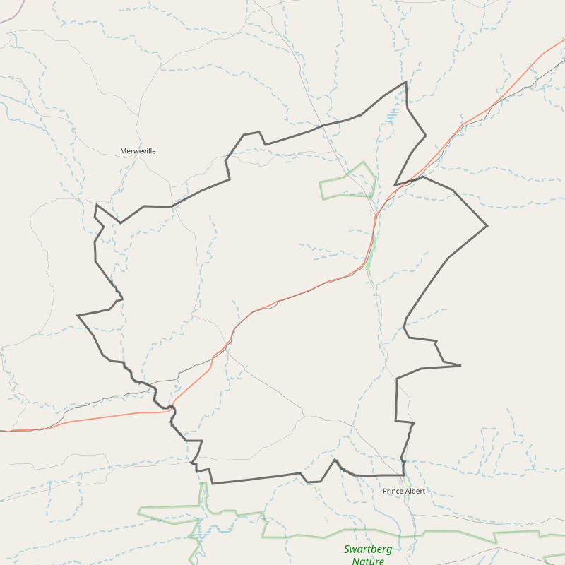
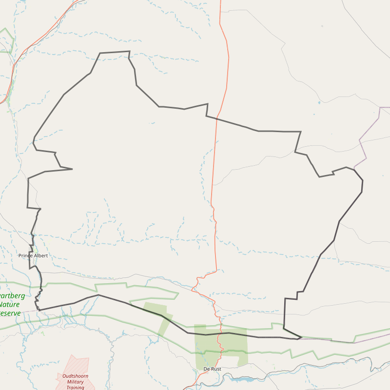
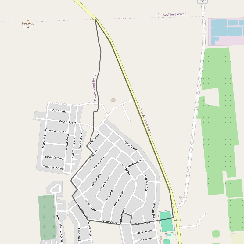
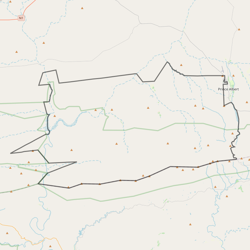
Prince Albert Municipality is divided into four wards, each encompassing distinct towns, farming areas and residential communities — from Leeu Gamka and Klaarstroom to the northern and southern sections of Prince Albert. This structure ensures that every part of the municipality is properly represented and served.

Each ward is supported by an active ward committee, elected by the community to assist and advise the ward councillor. Ward committees play a key role in distributing information, mobilising community involvement and promoting citizen participation in local governance.

Prince Albert Municipality currently has four ward committees, each representing its specific ward. These committees strengthen public engagement by:

  • Improving participation to inform Council decisions

  • Facilitating more effective communication between Council and the community

  • Assisting ward councillors with consultation processes and community report-backs

Ward committees are elected by the residents they serve. Each committee may have up to ten members, with strong representation of women. The ward councillor acts as the chairperson of the committee. While ward committees do not hold formal decision-making powers, they advise the ward councillor, make submissions to Council and play an important role in shaping the Municipality's Integrated Development Plan (IDP).

Ward map

Ward 1: Leeu-Gamka, Bitterwater, Prince Albert Road & Surrounding Farms

Ward 1 encompasses the northernmost parts of the municipality, including the towns of Leeu-Gamka and Prince Albert Road, the Bitterwater area, and adjacent farming regions. This ward is characterised by its rural landscape and agricultural activities.

KEY FEATURES:

  • Leeu Gamka: Located along the N1 highway, this town serves as a vital link between the Northern and Western Cape provinces.

  • Prince Albert Road: A small settlement primarily known for its railway station, facilitating transport and logistics.

  • Bitterwater: A farming community contributing to the region's agricultural output.

DEVELOPMENT PRIORITIES:

  • Infrastructure: Upgrading of roads, stormwater systems, and sanitation facilities.

  • Housing: Implementation of low-cost housing projects to address accommodation needs.

  • Services: Improvement of water quality and electricity supply, including the installation of street lighting.

  • Economic Development: Support for local businesses and agricultural initiatives to boost employment and economic growth.

Ward Councillor
Person photo Cllr Kiewiet Baadjies
Ward map

Ward 2: Klaarstroom, Seekoeigat, Die Gang & Prince Albert South

Ward 2 covers the eastern segment of the municipality, incorporating the village of Klaarstroom, the farming areas of Seekoeigat and Die Gang, and the southern part of Prince Albert town.

KEY FEATURES:

  • Klaarstroom: A picturesque village nestled at the foot of the Swartberg Mountains, known for its historical architecture and tranquil environment.

  • Seekoeigat & Die Gang: Agricultural zones contributing to the local economy through farming activities.

  • Prince Albert South: A residential area with a mix of housing and community facilities.

DEVELOPMENT PRIORITIES:

  • Water & Sanitation: Enhancing water storage capacity and upgrading sewage systems.

  • Infrastructure: Paving of roads and improvement of transportation networks.

  • Community Services: Establishment of educational and recreational facilities, including libraries and sports amenities.

  • Environmental Management: Implementation of recycling projects and conservation initiatives.

Ward Councillor
Person photo Cllr Linda Jaquet
Ward map

Ward 3: Portion of Prince Albert North

Ward 3 includes a section of the northern part of Prince Albert town, focusing on residential neighborhoods and associated community services.

KEY FEATURES:

  • Residential Areas: Housing developments accommodating a diverse population.

  • Community Facilities: Schools, healthcare centers, and recreational spaces serving local residents.

DEVELOPMENT PRIORITIES:

  • Housing: Addressing the demand for affordable housing options.

  • Infrastructure: Maintenance and upgrading of existing roads and public utilities.

  • Social Services: Expansion of educational and healthcare services to meet community needs.

Ward Councillor
Person photo Cllr Sidney Koonthea
Ward map

Ward 4: Portion of Prince Albert North, Rondomskrik & West End

Ward 4 comprises parts of Prince Albert North, including the neighborhoods of Rondomskrik and West End. This ward is primarily residential, with a focus on community development.

KEY FEATURES:

  • Rondomskrik & West End: Established neighborhoods with a mix of housing and local businesses.

  • Community Engagement: Active participation in municipal planning and development initiatives.

DEVELOPMENT PRIORITIES:

  • Infrastructure: Improvement of road networks and public transportation.

  • Housing: Development of new housing projects to accommodate population growth.

  • Community Services: Enhancement of public spaces, including parks and community centers.

Ward Councillor
Person photo Cllr Magrietha Jafta